14 October 2026
What counts as macroplastic in satellite-based river debris monitoring
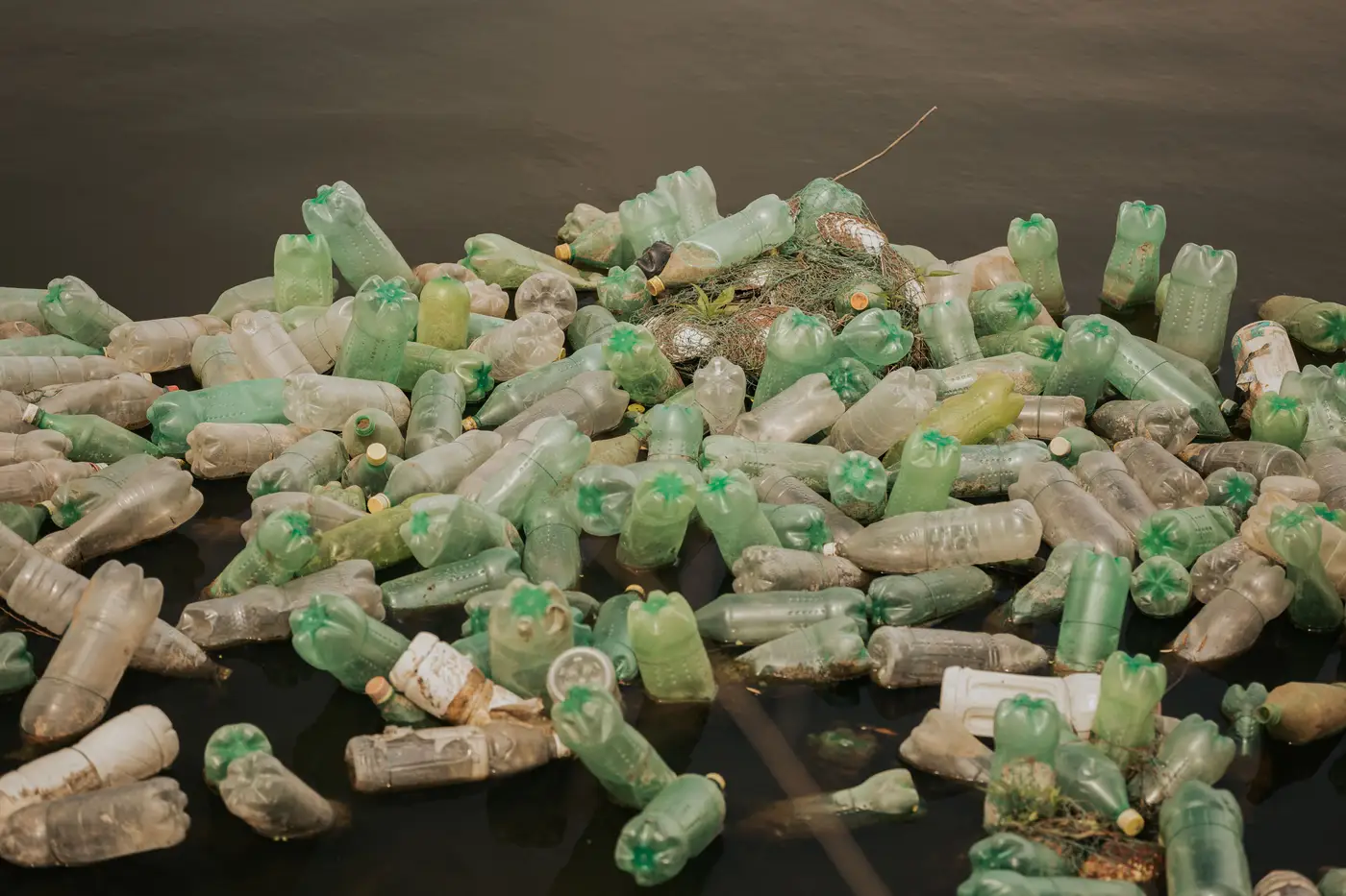
Macroplastic, in the context most interception crews care about, means anything big enough to snag a boom arm or jam a skimmer intake: bottles, bags, foam chunks, derelict fishing gear, the occasional pallet or tire. Microplastic is the fragmented stuff, flakes and fibers generally under 5mm, suspended in the water column or settled into sediment. The two categories don't just differ in size. They call for different monitoring methods entirely, and asking satellite imagery to track both is how a siting decision goes sideways.
Satellite-based debris monitoring, including the pilot signal behind this site, works in the macroplastic range. Anything smaller than what a sensor's pixel can resolve doesn't show up as a discrete object, a direct consequence of ground sample distance, the physical size each pixel covers on the water.
What a 0.5-2m pixel can and can't resolve
Ground sample distance (GSD) is the size of the area each pixel represents on the ground. At 0.5-2m GSD, a single floating bottle or bag is smaller than one pixel, sometimes much smaller. It won't register as its own detection. What does register is a cluster: a mat of debris caught in an eddy, a driftline strung along a bend, a raft of bottles and foam pressed up against a bridge pier after a storm. Those have enough contiguous area and contrast against open water to show up as a flagged patch in the imagery.
So the honest answer to "what size of debris can a satellite see" isn't a single number in millimeters. It's closer to this: individual items, rarely. Accumulations of items, often, once they've piled up enough to cover a few square meters. A programme coordinator sizing a boom off this data is looking at where debris collects, not counting what's in the pile.
Macroplastic vs microplastic in satellite imagery
Multispectral imagery picks up differences in how surfaces reflect light across visible and near-infrared bands. Plastic debris floating on water reflects differently than the water itself, which is the basis for flagging accumulation zones at all. Microplastic doesn't produce that kind of signal. It's too small, too diffuse, and often mixed into the water column rather than sitting on the surface in a way a sensor can isolate. No satellite platform, multispectral or otherwise, is tracking microplastic concentration from orbit today. Tracking microplastic concentration in a reach is a water-sampling and lab-analysis job.
Setting that boundary early keeps a programme's reporting honest. The satellite feed can't speak to microplastic loading in a reach, and saying so plainly in a report avoids blurring the two categories together.
What this means for siting a boom or crew
This distinction has one practical use for a programme coordinator: siting infrastructure. A monthly read flags where macroplastic has been accumulating along a stretch of river or coastline, debris that shows up as a mass rather than a single piece. That's exactly the information a boom-siting or cleanup crew needs: which bend, which backwater, which bridge approach is collecting debris this month, as opposed to where the last deployment happened to land.
Plastic Accumulation was built around that gap, a monthly multispectral read of accumulation patterns so interception infrastructure gets sited where debris is piling up. It's early access, a pilot signal rather than a mapped inventory of every piece of litter on the water, and it's scoped to macroplastic accumulation zones because that's what satellite imagery can honestly see.
If you're deciding where the next boom goes based on last season's observations or a volunteer's best guess, it might be worth seeing what a monthly accumulation read looks like for your stretch of river.